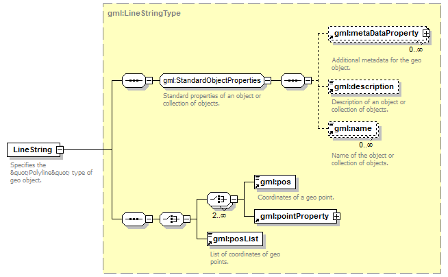
gml:LineString
Diagram
Description
Specifies the "Polyline" type of geo object.
This tag indicates that a geo object is a polyline and contains a description of its points.
There are two ways to set the point coordinates of a polyline:
- Using multiple gml: pos tags.
- Using the gml: posList tag.
In the first case, the coordinates of each point are wrapped in a separategml: pos tag; in the second case, they are listed in a more compact way within one gml: posList tag.
Tip. It is recommended to use the gml: posList tag for describing a polyline with a large number of points.
Contains:
gml:description, gml:metaDataProperty, gml:name, gml:pos, gml:posList
May be included in elements by substitutions:
gml:LineString
Part of a YMapsML document that describes the coordinates of the ends of a line segment:
<gml:LineString>
    <gml:pos>32.199411 58.601185</gml:pos>
    <gml:pos>32.189411 58.595185</gml:pos>
</gml:LineString>